
In preparation for tonight’s Neighborhood Council Public Safety Committee meeting, I wanted to check on the state of crime in our neighborhoods of Westchester, Playa Del Rey and Playa Vista. Having heard of a number of people reporting burglaries in late December, I wanted to check on whether the trends had continued or had abated.
At our last Neighborhood Council board meeting on January 7, we heard from our senior lead officers (SLO) Sophia Castaneda and Luis Pinell that they had some suspects they were pursuing. They described them as 4 african american males wearing ski masks. They were believed to have been responsible for several of the burglaries in Westchester, specifically Westport Heights and Kentwood neighborhoods.
I have come to rely on the CrimeMapping service that offers an easy to use web site where you can search for addresses, filter on specific types of crime and then produce maps and reports based on your search. What is strange is that there do not appear to have been any crimes reported in the new year. According to CrimeMap’s FAQ, the “data we post is gathered with the permission of each agency and is updated on the site once per day.” I have put in an inquiry to CrimeMap to see why the data does not appear to have been updated in the past 2 weeks for Westchester / Playa; it is hard to believe there have been no crimes reported anywhere in 90045.
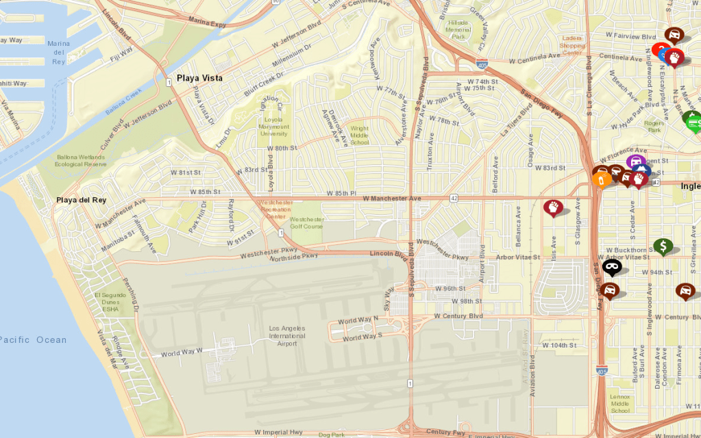
Given that, here is a look at the last ~6 weeks of crimes in and around 90045. These are from screen shots I took of the map from CrimeMapping website. The first week I looked at, starting on 12/11/19, is what I have generally observed to be the “normal” conditions in our neighborhoods. A collection of theft/larceny ![]() and vehicle break-in
and vehicle break-in ![]() crimes along with a few vehicle thefts
crimes along with a few vehicle thefts ![]() . While still disturbing, my understanding from LAPD and others is that this is a fairly typical urban baseline crime rate.
. While still disturbing, my understanding from LAPD and others is that this is a fairly typical urban baseline crime rate.
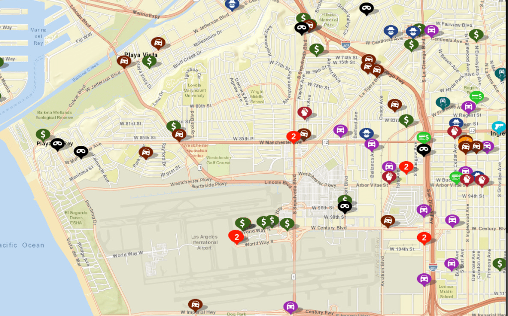
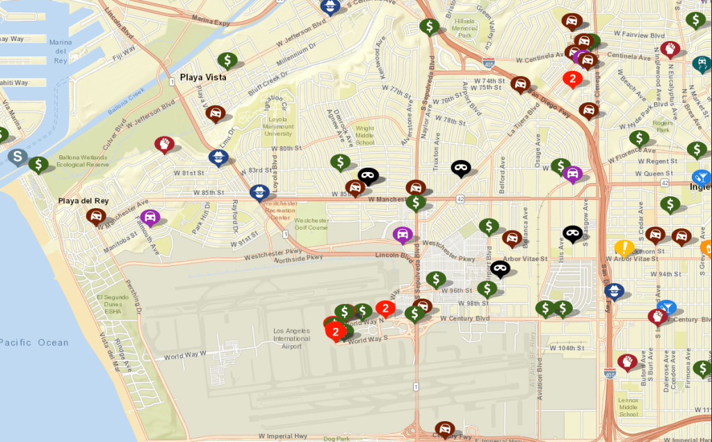
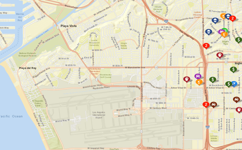
From the map above, you’ll notice that there were no burglaries in Westport Heights or Kentwood with a few in Playa Del Rey. Also, you’ll see a concentration of theft/larcenies at the airport. Things start to get interesting and unsettling starting the following week, starting 12/17/19 when holiday traveling starts in earnest. While the number of overall crimes in the neighborhood generally stayed level at around 140 in this window and slightly beyond, two things started to change. First, you’ll notice the number and variety of crimes around the airport increased and then there are new burglaries in Westport Heights and Kentwood. The crimes at the airport are likely holiday travelers getting their luggage and other belongings stolen – is this simply because there are more travellers starting to go through the airport or that the pick pockets and luggage thieves have stepped up their game. Hard to say.
The following week, we see a slight increase in crimes reported and a real growth in burglaries in Westport Heights. This appears to be the start of the crime spree that the 4 suspects went on. You also see the number of crimes in the airport area increase including a vehicle theft.
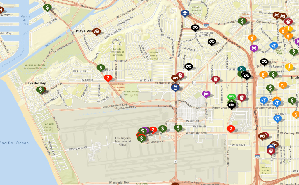
The burglaries in Westport Heights all occured in the mornings between 8:00 and 11:00 on 12/30 and 12/31. If I recall, at least one of the residents was still in town, so these are not necessarily burglaries that happened at residences where the owners were out of town for the holidays.
One thing to look at with this data would be to compare the burglary locations to construction activities in the neighborhood. I first became interested in these trends last year when i noticed a direct correlation between burglaries in Westport Heights that were adjacent to active or recently completed major home remodeling projects. With access to roofs and back yards, construction crew have unprecedented opportunities to understand the patterns of the occupants and means to break in. This is not to suggest that the construction crews are burglarizing the homes but there is a direct correlation at times. That this year’s burglaries were perpetrated by a team of 4 suggests a different approach.
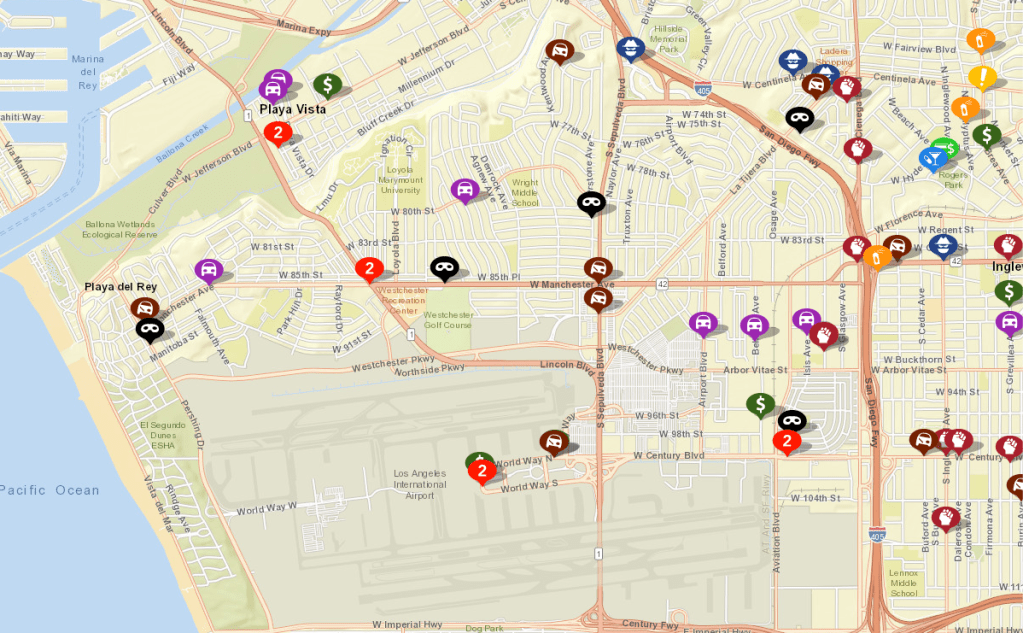
I would have to dig into data from 2018 and 2019, but the trend in crime in the area starts to significantly decline after the new year. Unfortunately, the CrimeMappings service only retains the last 180 days of data. In the first full week of 2020 we see only 76 reported crimes in the area including a reduction in the number of crimes reported at the airport.
So, at tonight’s Neighborhood Council of Westchester / Playa’s Public Safety Committee meeting I will ask our SLOs whether the data is possibly not making it into CrimeMapping’s database or there is some other anomaly going on. Would that we are so lucky that no crimes are occuring in our neighborhoods.
